
June 24, 2019
Debatable Ground
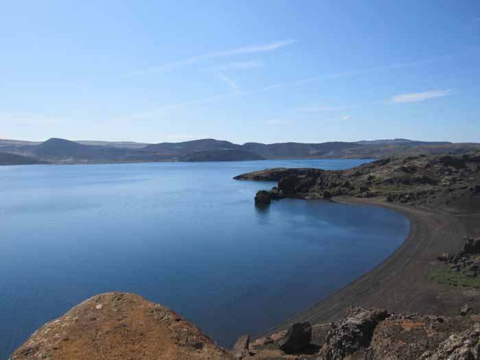 So here we are atop the Mid-Atlantic Ridge, on the neutral ground between the North American tectonic plate and the Eurasian plate. Because the land here is very new, there’s not much in the way of bedrock to support it, and in places it’s sort of collapsed— though not here, where this lake can be found in newly-formed highlands. The sources of this lake are rainwater and springs, and there’s no exit, but trout have found their way into the lake, so at least there’s fishing.
You also see black volcanic sand and precious little plant life. In Iceland you can drive for miles through lava flows, where the only vegetation is “gray moss,” a spongy plant that over many centuries erodes the lava just enough so that it can be replaced by . . . green moss! Which continues the erosion process until some scrub can finally take root.
There are some impressive lava fields near Reykjavik, but the lava fields of the south are simply vast, and produce hours of the most boring driving imaginable, with nothing but gray moss and distant mountains to look at. This was all laid down in the eruption of Laki in 1783, in which a 25-kilometer gash opened up in the earth, and poured out lava for five months, and intermittently for the next 11 years. Most of Iceland was covered by ash and cinders contaminated by fluorine, which killed most crops and maybe half the livestock. Though few lives were lost in the actual eruption, nearly a quarter of the population died of starvation— and this a few years after a smallpox epidemic that killed 33%. The Danish government contemplated evacuating the entire island, and sent a ship to Reykjavik to evacuate whoever wanted to leave— though when the people were told they were intended to colonize the barren sand dunes of Jutland, they responded “We can starve to death here just fine, thank you.”
The eruption was so vast that it had enormous geopolitical consequences. A sulphur dioxide fog settled over much of Europe, so thick that ships could not leave port. As people are not equipped to breathe sulphuric acid, thousands died. The freezing winter of 1784 caused widespread famine, notably in France, where it probably contributed to the French Revolution.
In America, the Chesapeake froze over. In Asia the monsoon cycle was disrupted, and the Nile failed to flood, resulting in the starvation deaths of a sixth of the population of Egypt.
Active geology can be pretty damned scary.
Another feature of southeastern Iceland is the way the houses are clustered on high points. Many active volcanoes are covered by glaciers, so when there’s an eruption a lot of ice gets melted in a very short amount of time. This stuff finds its way to lower levels, and the results can be mass flooding. The floods not only carry water, but also cinders, big rocks, and whole icebergs. Past experience has shown which areas flood and to what depths, and so farmhouses are clustered above the high-water line. Since churches tend to be built on high points, the area is full of stories of churches being saved from catastrophe by divine intervention, while the actual cause seems to have been topology.
These floods can build very rapidly. We visited one town— it may have been Vik, but I don’t remember— where the inhabitants are expected to evacuate on 40 minutes’ notice. Good luck with that, say I. (We lodged well above the flood line.)
Vulcanologists are now very good at predicting eruptions, but this is usually with volcanoes they can see. A volcano buried under two kilometers of ice is a very different problem. They listen for micro-quakes and send helicopters over the glaciers to visually look for changes.
But still— 40 minutes’ warning. My advice is not to silence your phones at night.
Reader responses
Comments
Be the first to respond.